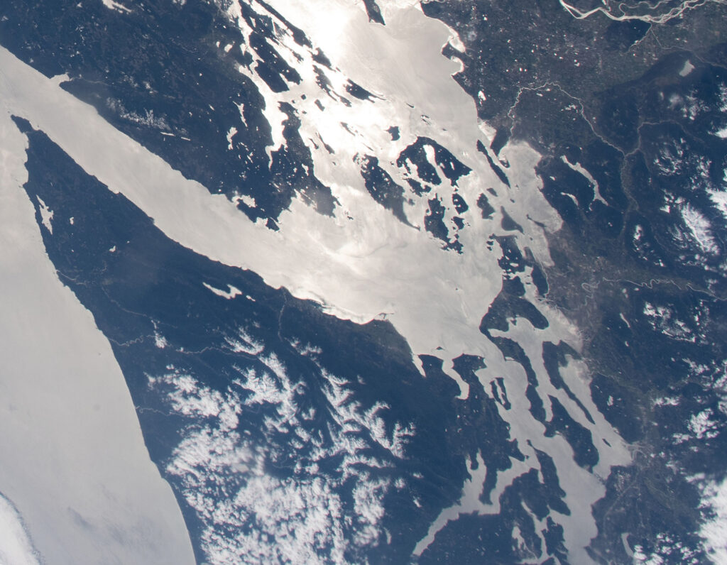
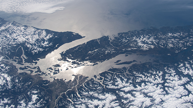
Salish Sea viewed from International Space Station
by Jeff Noedel
One of my favorite photos of the Salish Sea is one taken April 11, 2020 from the International Space Station.
I like this for many reasons:
- from space, Earth looks monochromatic (tints of gray, except for snow and the reflection of the sun and large waves in the water far offshore
- There are no visible borders. U.S. versus Canada; Seattle looks the same as Friday Harbor
- From space, Earth looks quiet
The original version of this photo looks down onto the Salish Sea from the Northeast.
I rotated this photo to imagine the same image viewed from the south — so that the islands are more relatable to the way we see them on maps. However, that rotation makes the sun come from the wrong direction.
From any angle, this photo is amazing. It uses the reflection of the sun to reveal the water — the Pacific Ocean, the Salish Sea, even rivers and tributaries.


Thank you for posting this photo! Beautiful!